Ken Larsen's web site - 817 Tinkerbell rezoning issue
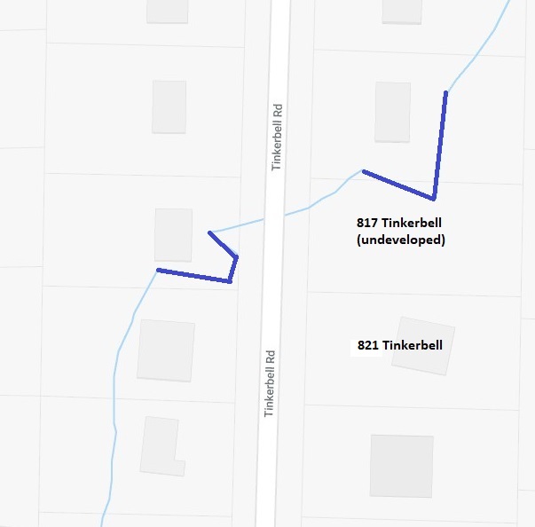 |
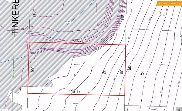
Map showing
Tinkerbell road, the creek, and two properties (817 and 821) that
were once owned by the
same person. In 2012 Max Mason bought 821. The current owner of 817 is Joe Monitor. He bought it in 2018 (?). CD Mock is presenting a proposal to the Board of Variance to allow him to build on 817. He's had 817 under pending contract since April of 2018. The creek (shown in blue) is called the "Tracy branch". It's a branch of Little Creek. Shown in dark blue is where the creek was rerouted to provide more room to build a house. Tracy branch flows from the upper right to the lower left on this map. |
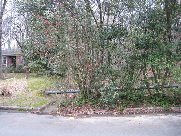 |
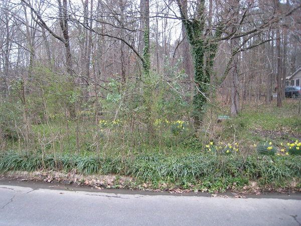
Northern end of 817 Tinkerbell is shown with a yellow cone in the street. |
 |
|
 |
|
 |
|
 |
|
 |
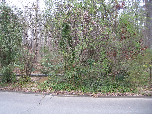
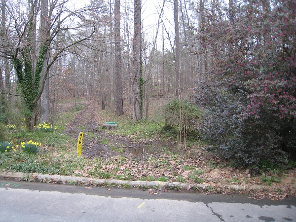
Southern end of 817 Tinkerbell is shown with a yellow cone in the street. |
 |
GIS map showing 817 Tinkerbell outlined in red. Assessed value in January of 2009 was $ 28K. This was raised to $ 110K in January of 2017 ... the same as 815 Tinkerbell and 821 Tinkerbell. This was a mistake, in my opinion. This GIS map does not show the OWASA sewer line or the boundaries of the RCD (Resource Conservation district). Those greatly diminish the value of the property. |
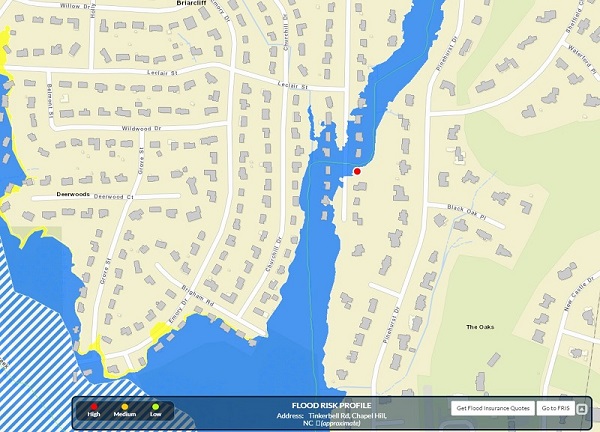
Flood Map with 817 Tinkerbell identified as a red dot
817 Tinkerbell property
Setbacks/requirements for stormwater (Jordan Lake buffer), Owasa, Flood plain and Resource Conservation District and others:
For Jordan Lake
- Requires state approval
- Can involve public process
- Involves first 50 ft from stream
- Jordan Lake variance is difficult to obtain.
For Flood Plain
- Runs through whole property to street. Building on it requires an 18 ft elevation for any building.
For RCD (Resource Conservation District)
- 150 ft from stream (would encumber whole property)
- Easier allowance to receive- it just goes through Chapel Hill.
- Requires a survey from an independent surveyor to mark the RCD.
- No public input as long as he meets regulations
- If it involves a 500 ft boundary- the town notifies the neighbors (this property isn't large enough)
For property/street (R1 setback)
- 14 ft from property lines (Max/Borianna's and Pinehurst neighbors)
- 28 ft from street
Aesthetics/Architecture
- CH Planning does not have the ability to review
- There are neighborhood conservation districts in the town that have the ability...our neighborhood doesn't have one
- As long as he meets building codes, he should be fine
- There are height limits (based on a formula). Primary height is usually 29 ft (2 1/2 stories) From what she can tell, his height max is 40ft (3-4 stories).
There's a 50
ft Jordan Lake buffer that the builder will need a variance for
if he decides to build in that area. If so, Stormwater will
review and the builder will need to go to the CH Board of
Adjustments to receive the variance.
- Knows that
the builder needs to notify the neighbors if he plans to build
in the RCD- he wasn't sure of the neighbor input/feedback
process. He also mentioned that once we receive the plans from
the builder, we could follow-up with him or the other two
engineers on his staff.