Ken Larsen's web site - Ephesus-Fordham Flooding Issues
Severe floods have struck Chapel Hill six times since 1972:
-
June 21, 1972 (Hurricane Agnes)
-
September 6, 1996 (Hurricane Fran) - 24 years later
-
September 6, 2008 (Hurricane Hanna remnants) - 12 years later
-
September 21, 2011 - 3 years later
-
June 30, 2013 - 2 years later
-
December 23-30, 2015 (2 years later) Almost continuous rain during this week. Booker Creek overflowed its banks. Some apartment complexes had to be evacuated.
-
October 8, 2016 Rains from Hurricane Matthew strike North Carolina and cause severe flooding.
-
September 17, 2018 Rain from Hurricane Florence strikes North Carolina. 9 inches fell on Chapel Hill over three days; 30 inches fell on Eastern North Carolina. [details]
Below is a link to video and
pictures from the flood of June 30, 2013.
The common
response from Town Council members has been:
“The low lying properties should never have been built.
They were developed in the 1960s – prior to being annexed by Chapel
Hill and before flood zone regulations came into being (1970s).”
I agree 100% with that assessment, but unfortunately we can’t go back
in time and rectify that mistake.
|
|
Colonial Arms apartments |
| Video of flooding on Grove Street June 30, 2013 [taken by Kim Cusic] | Briarcliff |
|
|
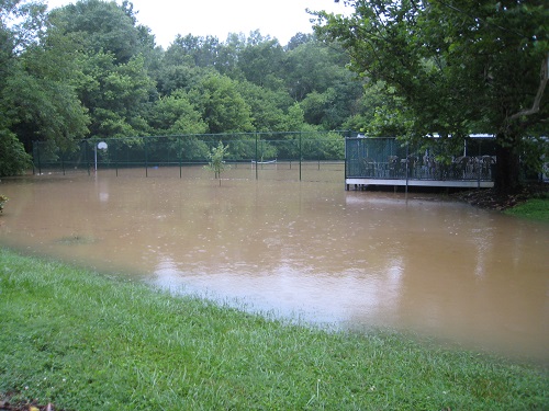
Ridgewood Pool Club
June 30,
2013 |
|
|
|
|
|
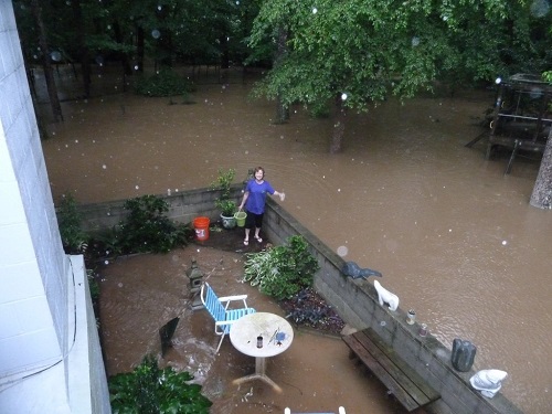
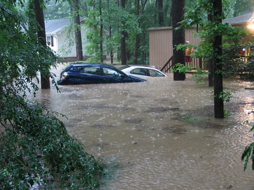
South end of Emory Drive
June 30, 2013
Note the two mailboxes. The house of Martha and David Dill belongs to the one on the left. |
|
|
|
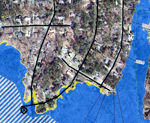 |
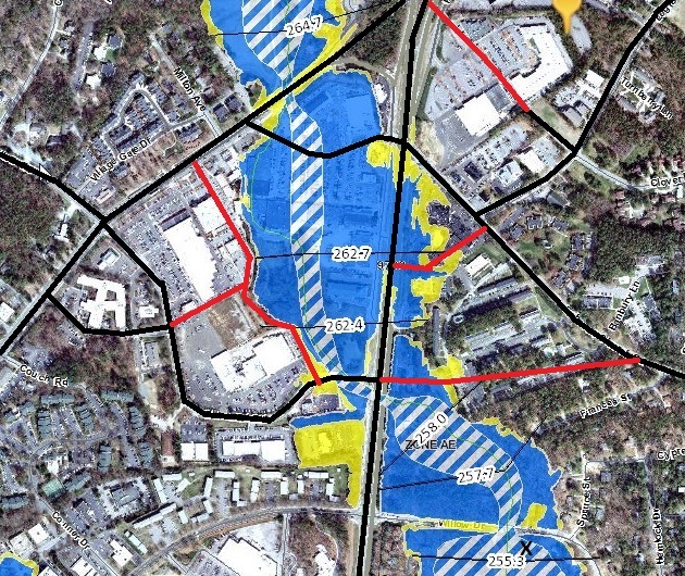
FEMA flood map showing the Dill's house marked with an X. Blue shows the 100 year flood zone. Yellow shows 500 year flood zone. I highlighted the main roads in black. |
|
|
1547 Ephesus Church Road
June 30, 2013
This is near
Little Creek
tributary 3 in the FEMA maps. |
 |
1100 Willow Drive
June 30,
2013 |
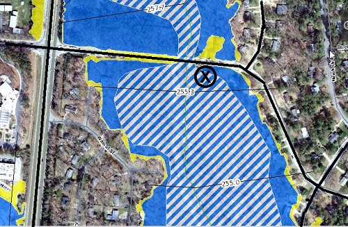 |
FEMA map with main streets marked in black, and X marking the
location of 1100 Willow Drive.
Blue = 100 year flood zone. |
 |
500 Longleaf
June 30, 2013 |

 |
Flood Risk
Information Map. (See http://www.ncfloodmaps.com/ ) Blue = 100 year flood zone. Yellow = 500 year flood. Red = proposed new roads X marks a house that "could not be built under current Chapel Hill rules" per Council member Ed Harrison. Has the Town received permission from FEMA and the State to bisect the flood plain with the new roads? |
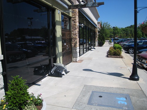 |
(May 3,
2014) Sandbags ready for use by Eastgate merchants. There was
a flash flood warning a few days earlier. The storm water
system under Eastgate easily overflows, so merchants are quick to
get sandbags out. Per the previous FEMA map, Eastgate lies in a 100 year flood zone. By today's standards it would be zoned RCD (Resource Conservation District); however, the Town wants to up-zone it to 7 stories. This is insanity, in my opinion. |
|
Site |
Impervious surface (square feet) |
|
ABC
Store |
20,000 |
|
American Board of Pediatrics addition |
28,000 |
|
Carolina North |
? |
|
Central West |
? |
|
Charterwood (site of Booker Creek
Headwaters) |
217,000 |
|
Children's Campus |
31,000 |
|
Courtyard |
391,000 |
|
Ephesus/Fordham |
Up to 20% increase |
|
Goodwill |
9,000 |
|
IFC Transitional Housing addition
|
33,000 |
|
Timber Hollow expansion |
66,000 |
|
Weaver Crossing |
10,000 |
| Total: | 1,195,000 |